Decoding the Differences in Satellite Imagery (Part 2)
Last updated: 18 May 2026 | 43 Views |

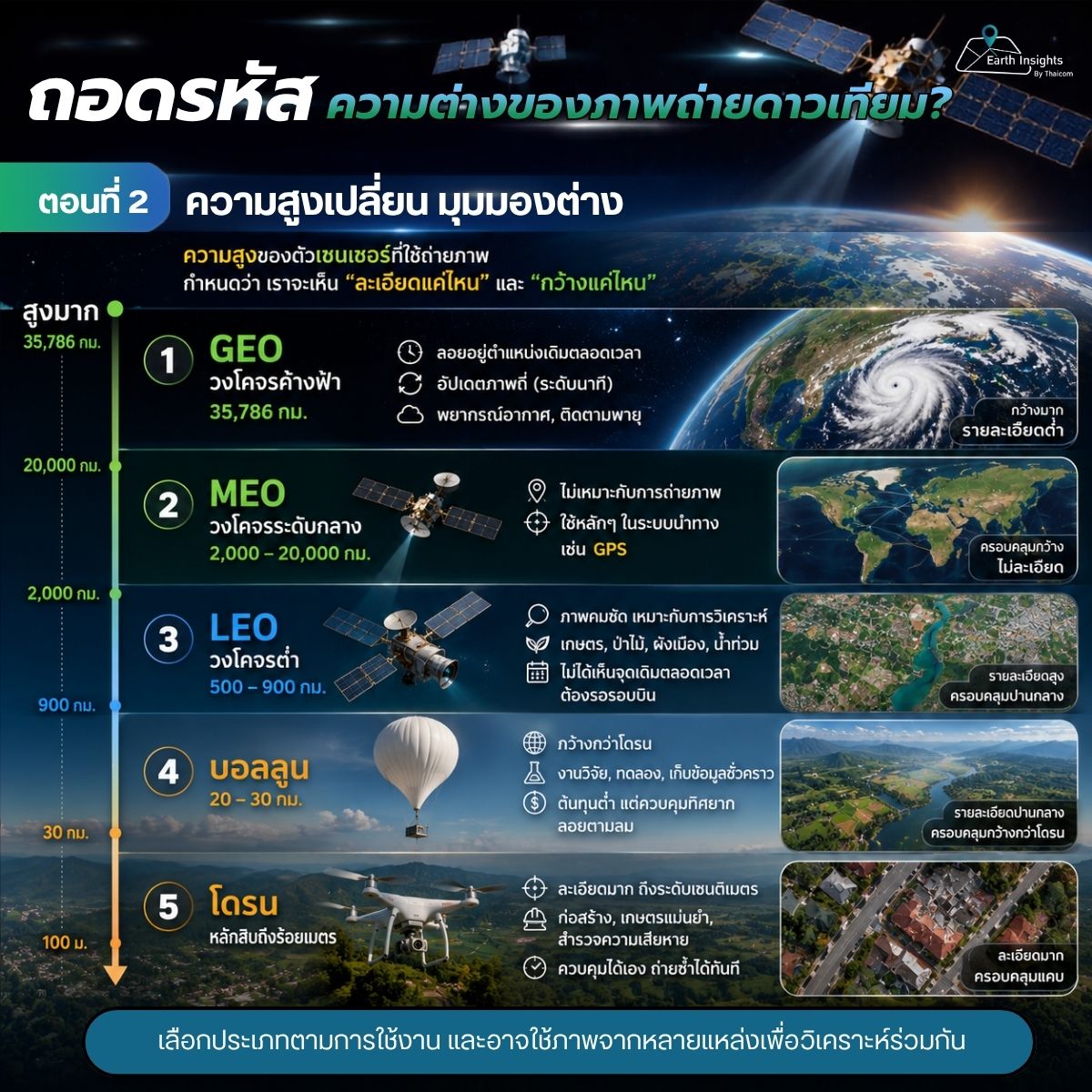
Part 2. How Altitude Changes What We See
In Part 1, we learned that satellite images look different because they are captured using different wavelengths of light. However, there is another equally important factor: the altitude of the sensor capturing the image.
The distance from Earth determines both how detailed the image is and how wide an area it can cover.
Why Does Altitude Matter?
Think of it like zooming a camera:
Zooming in reveals fine details
Zooming out shows a broader view
Satellite imagery works in the same way.
The closer the sensor is to Earth, the more detail it can capture.
The farther it is, the wider the coverage and the more continuous the observation.
1. Very High Altitude: Geostationary Orbit (GEO)
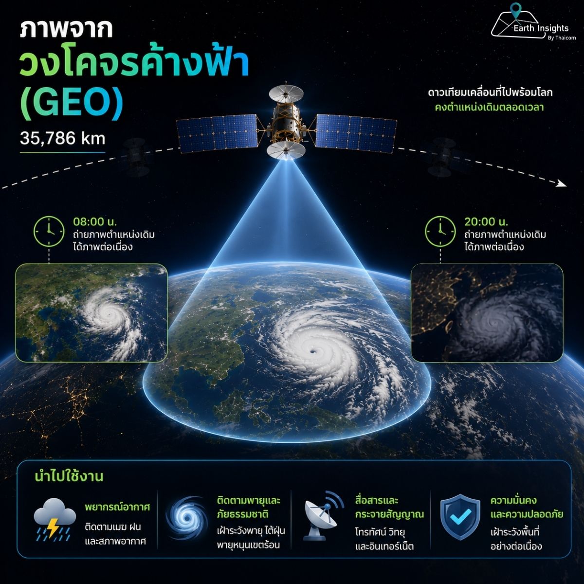
Satellites in this orbit operate at approximately 35,786 kilometers above Earth.
Their key feature is that they remain fixed over the same location.
This allows them to:
- Continuously observe the same area throughout the day
- Update imagery very frequently (down to minutes)
Common uses include:
- Weather forecasting
- Monitoring storms, clouds, and rainfall
Image characteristics:
- Very wide coverage across entire regions
- Lower spatial detail compared to lower orbits
2. Most Common for Imaging: Low Earth Orbit (LEO)
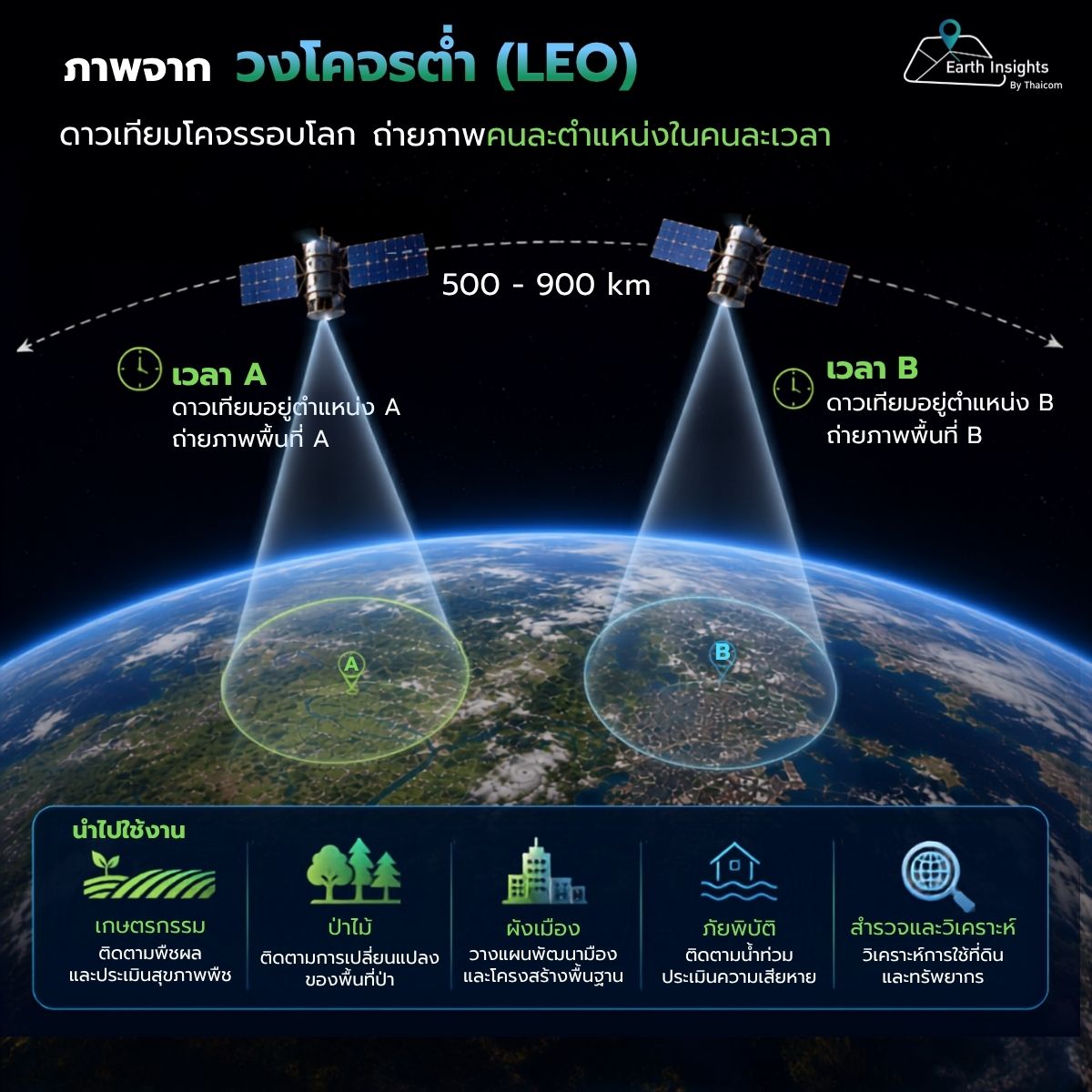
Most satellites used for Earth observation operate at around 500–900 kilometers above Earth.
Key advantages:
- Higher image clarity
- Well-suited for analyzing surface features
Common applications : Agriculture, Forestry, Urban planning, Flood monitoring
Limitations:
- They do not continuously observe the same location
- Revisit requires waiting for the next orbital pass
Beyond Satellites: Closer-to-Earth Alternatives
For even higher detail at closer range, other platforms such as drones and balloons are also used.
Drone Imagery
Drones typically operate at altitudes ranging from tens to a few hundred meters. They can capture extremely high-resolution imagery at the centimeter level.
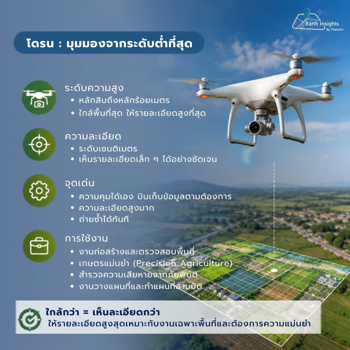
Common uses include:
- Construction monitoring
- Precision agriculture
- Damage assessment
Balloon-Based Imaging
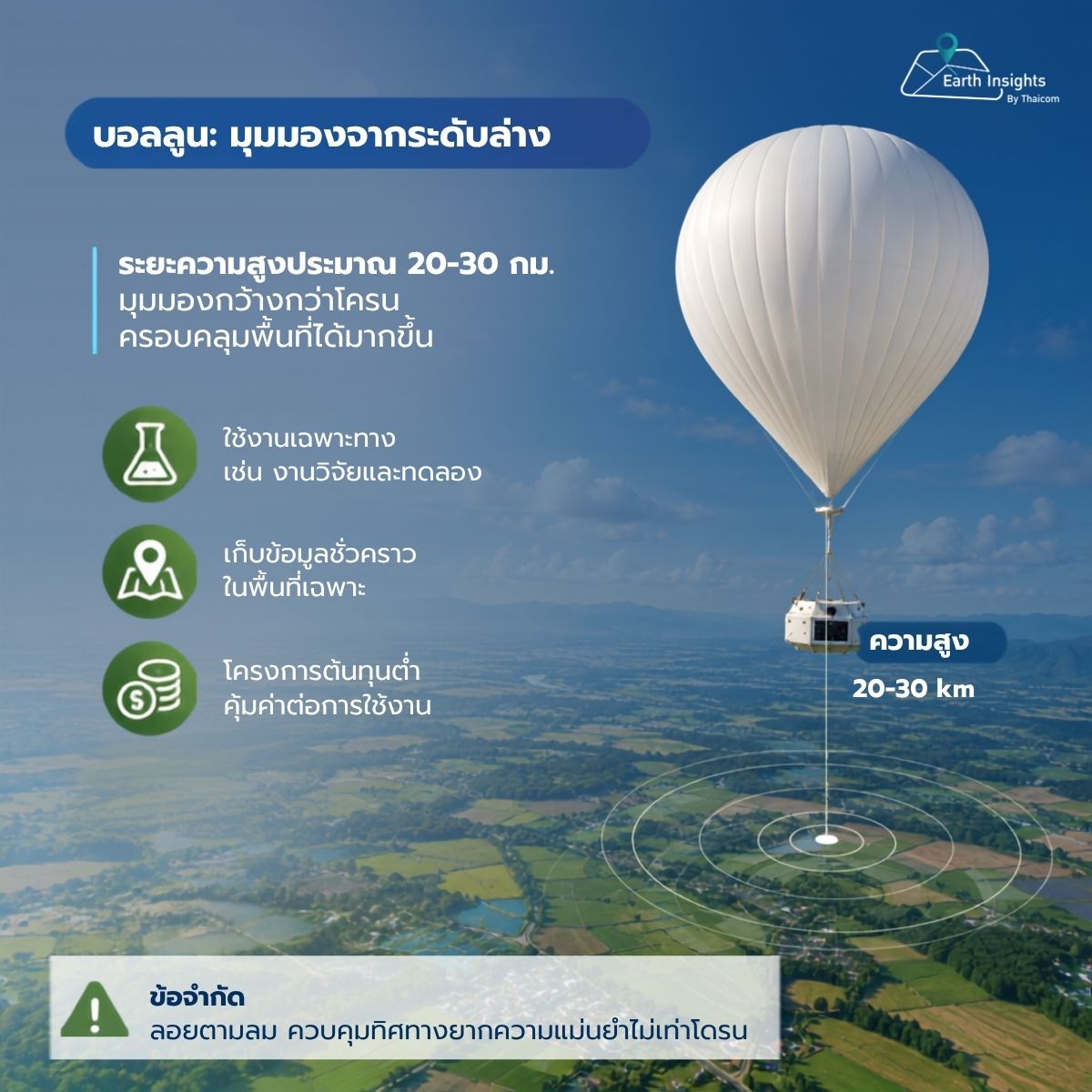
High-altitude balloons operate at around 20–30 kilometers above Earth.
They provide wider coverage than drones and are often used for:
- Research and experimental purposes
- Temporary data collection over specific areas
- Low-cost observation projects
However, they are less precise than drones because they drift with the wind and are difficult to control.
What About MEO?
At this point, you might wonder whether there are images from Medium Earth Orbit (MEO).
MEO satellites operate at approximately 2,000–20,000 kilometers above Earth.
In practice, this orbit is rarely used for imaging because:
- It is too far to achieve high-resolution imagery like LEO
- It cannot provide continuous observation like GEO
Summary
We can now see that altitude plays a key role in determining both the perspective and the level of detail in satellite imagery.
In the next article, we will take a deeper look at image resolution and how it affects what we can observe from above.
")

")
")
")